Master Spatial Analysis: The Key to Unlocking the Power of GIS
Geographic Information Systems (GIS) are a powerful tool for understanding and analyzing data with a spatial component. At the heart of GIS is the ability to overlay and analyze multiple layers of data, allowing for a more comprehensive understanding of the relationships and patterns within the data. However, to truly unlock the power of GIS, one must master the art of spatial analysis.
Spatial analysis is the process of using GIS software to examine and interpret spatial data. This includes not only the visualization of data, but also the quantification and modeling of spatial relationships. Mastering spatial analysis allows for a deeper understanding of the data, leading to more accurate and informative conclusions.
Understanding the Basics of Spatial Analysis
Before diving into the more advanced techniques of spatial analysis, it is important to have a solid understanding of the basics. This includes understanding the different types of spatial data, such as vector and raster data, as well as the different coordinate systems used to represent this data.
It is also essential to have a good grasp of the fundamental GIS operations, such as querying and selecting data, as well as the ability to create and edit spatial data. These basic skills form the foundation upon which more advanced spatial analysis techniques can be built.
Using GIS for Spatial Analysis
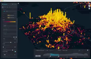
GIS software provides a wide range of tools for performing spatial analysis. These tools can be used to create maps and visualizations, as well as to perform quantitative analyses such as spatial statistics and modeling.
One of the most commonly used tools in GIS for spatial analysis is the use of overlay operations. Overlay operations allow for the combination of multiple layers of data, allowing for the analysis of the relationships and patterns between them. This can include union, intersect, and difference operations, as well as more advanced operations such as buffering and proximity analysis.
Another important tool in GIS for spatial analysis is the use of spatial statistics. Spatial statistics allow for the quantification of patterns and relationships within spatial data. This can include measures such as density, centrality, and spatial autocorrelation.
Advanced Techniques in Spatial Analysis
While a solid understanding of the basics and the use of GIS tools is important, true mastery of spatial analysis requires a deeper understanding of the underlying principles and advanced techniques.
One such technique is the use of spatial modeling. Spatial modeling allows for the creation of predictive models based on spatial data. This can include techniques such as spatial regression and spatial decision trees.
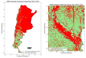
Another advanced technique is the use of remote sensing and image analysis. Remote sensing involves the use of satellite and aerial imagery to gather data. Image analysis allows for the extraction of information from these images, such as land cover and land use classifications.
Conclusion
In conclusion, spatial analysis is a crucial component of GIS and is essential for unlocking the full potential of this powerful tool. A solid understanding of the basics, combined with the use of GIS tools and advanced techniques, is necessary for mastering spatial analysis. With the ability to analyze and interpret spatial data, one can gain a deeper understanding of the relationships and patterns within the data, leading to more accurate and informative conclusions.


