Uniform Grid Geospatial Data Structure: Functionality, Benefits, and Limitations
Introduction
Among the array of data structures used for geospatial data management, the Uniform Grid stands out due to its simplicity and efficiency. Used for handling spatial data in a variety of applications such as gaming, physics simulations, and GIS, the Uniform Grid is designed for both practicality and performance. To appreciate its full potential, we need to understand its functionality, benefits, and limitations. This article provides an in-depth overview of the Uniform Grid as a geospatial data structure.
What is Uniform Grid?
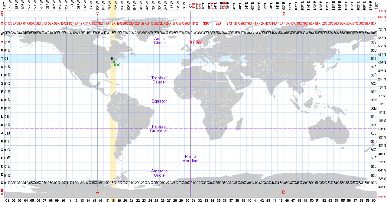
A Uniform Grid is a spatial data structure that divides the entire space into equal-sized cells, forming a grid. Each cell in the grid can store data points that fall within its boundaries. This grid-based system simplifies spatial queries and operations, as the resolution of the grid remains consistent throughout the space.
How Does Uniform Grid Work?
The Uniform Grid divides the spatial region of interest into equal-sized cells, forming a 2D or 3D grid. Each cell in the grid can store one or more data points. When performing a spatial query, the algorithm only needs to search within specific cells rather than scanning the entire data set. This strategy makes the data structure efficient for collision detection and nearest neighbor search, among other spatial queries.
To explain it with an analogy, consider a city map divided into equal-sized squares, where each square represents a specific area of the city. If we need to locate a particular building, instead of searching the entire city map, we can identify the square in which the building is located, and search only within that square.
Benefits of Uniform Grid
- Efficiency: One of the primary benefits of a Uniform Grid is the efficiency it brings to spatial queries. By segmenting the space into regular cells, the grid reduces the number of comparisons needed in a query, speeding up search times considerably.
- Simplicity: The Uniform Grid structure is conceptually straightforward and relatively easy to implement. The regularity of the cells and the simplicity of the operations make it an attractive option for many applications.
- Scalability: Uniform Grids can easily scale to handle large datasets. Regardless of the size of the data, the performance of spatial queries remains consistent because only the relevant grid cells are searched.
Limitations of Uniform Grid
- Fixed Resolution: The resolution of a Uniform Grid is fixed, which can be a limitation when dealing with datasets of varying density. In areas where data points are sparse, the grid cells may be under-utilized, whereas in dense areas, cells may become overcrowded.
- Memory Consumption: Uniform Grids may require substantial memory, especially in three dimensions. This is because every cell in the grid requires memory, even if it does not contain any data points.
- Inefficient with Non-Uniform Data: For non-uniform data, a significant portion of the grid cells may be empty, leading to an inefficient use of memory and potentially slower queries.
Conclusion
The Uniform Grid structure, despite some limitations, offers a simple yet powerful tool for handling geospatial data. Its efficiency, simplicity, and scalability make it widely used in various fields. However, its fixed resolution and potential for high memory consumption necessitate careful consideration when choosing the right tool for geospatial data management. For further insights into spatial data management, consider exploring our comprehensive guide on geospatial data structures.


