Geohashing Geospatial Data Structure: Functionality, Benefits, and Limitations

Introduction
The Geohash data structure is a powerful tool in the world of geospatial data management, offering a compact, efficient, and precise means of encoding geographical coordinates. By understanding the functionality, benefits, and limitations of Geohashing, users can harness its strengths for a wide range of applications, from spatial indexing to geotagging and proximity searches. This article unravels the workings, advantages, and shortcomings of Geohashing as a geospatial data structure.
What is Geohashing?
Geohashing is a geocoding method used to encode geographic coordinates (latitude and longitude) into a short string of letters and numbers. The system was created by Gustavo Niemeyer in 2008. The primary aim of Geohashing is to convert lengthy numerical coordinates into simpler alphanumeric representations, thus making them easier to use, remember, and share. The longer the Geohash, the more precise the location it describes.
How Does Geohashing Work?
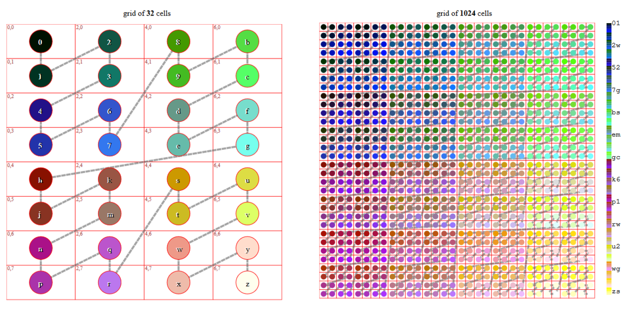
Geohashing works by dividing the world into a grid of squares, assigning each square a unique hash value. The process starts by bisecting the world into two regions, encoding the west or east hemisphere as 0 or 1, and similarly, encoding the south or north hemisphere as 0 or 1. This process continues, each step dividing the regions further, and assigning a binary value to each subdivision. This sequence of binary values forms a binary string, which is then converted into a base-32 representation, where numbers from 0-9 and letters from b-z (excluding a, i, l, and o to avoid confusion) are used.
Geohashing Explained to a Ten Year Old
Imagine you're playing a game of hide and seek in a large park, and you want to tell your friends where you are hiding without making it too easy. Instead of describing the exact location (like "I'm hiding behind the large oak tree next to the pond"), you divide the park into numbered sections. So, you might tell them "I'm in section 3." But if your friends haven't found you yet and need more help, you could divide section 3 into smaller sections (like 3a, 3b, 3c, etc.) and give them another hint: "I'm in section 3b."
That's similar to how Geohashing works. It takes a big place (like the entire world), and gives every small part of it a unique code. If you only give a short code, it points to a large area. If you give a longer code, it points to a smaller area. This allows us to share our location in a way that is as precise or as general as we want.
Benefits of Geohashing
Simplicity and Versatility: Geohashing simplifies geospatial data handling by reducing complex coordinates into manageable strings. It's versatile as the length of the hash can be increased or decreased for precision or generalization respectively.
Efficient Proximity Searches: Geohashing is excellent for proximity searches. By comparing the prefixes of Geohashes, one can effectively determine the proximity of two locations.
Ease of Implementation: Geohashing is easier to implement compared to many other spatial data structures. It does not require complex algorithms or balancing operations.
Limitations of Geohashing
Precision Limitations: Geohashes can become quite long if high precision is needed. This may negate the benefit of simplicity for some use cases.
Edge Case Inaccuracy: Locations that are geographically close but fall on different sides of a geohash boundary will have very different geohashes, complicating proximity searches.
Non-uniform Distribution: Earth is a sphere, but geohashes treat it like a flat surface, leading to distortions especially near the poles. The size of a geohash square varies based on latitude.
Conclusion
Geohashing presents an innovative, efficient, and simple way to handle geospatial data. While it has its limitations, such as edge case inaccuracies and precision issues, the benefits of simplicity, efficient proximity searches, and ease of implementation make it a popular choice for geocoding. As with any geospatial data structure, understanding its intricacies is key to making the most of its potential. Continue to explore other geospatial data structures to build a comprehensive understanding of the field.


