Importance of Open Source GIS software
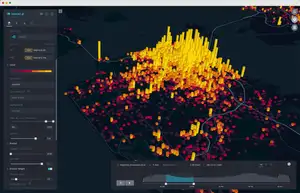
Geographic information systems (GIS) is a series of computer programs that link geographic features in a database with information about them. This allows users to map out data, analyze it, and share the results. The use of open source GIS software can save companies money and allow greater flexibility than proprietary GIS systems do.
Open Source GIS Software is an Alternative to Proprietary GIS Software.
Proprietary GIS software is expensive, whereas open source GIS software is free. Open source GIS software can be run on a variety of operating systems, whereas proprietary systems are only available for one or two operating systems. Open source systems often have similar functionality and quality to proprietary products.
Open Source Software is Free and Does Not Have Restrictions on Use or Redistribution.
It can be used for any purpose, including commercial applications, without paying any fees to the author or copyright holder. Additionally, open source GIS software can be modified and redistributed as it is under a license that permits this type of activity.
The idea of free GIS software isn't new; Esri was founded in 1969 specifically to develop and distribute such products after finding that many customers were using public domain systems.
In fact, many modern GIS technologies are built on top of open source code such as PostgreSQL or MySQL databases—both of which provide their source code freely as well.
Open Source Means That the Original Source Code is Available for Users to Modify and Adapt to Suit Their Needs.
Open source software is free to use. It allows you to see the source code, modify it and adapt it to suit your needs. You can also share and redistribute open source software with others.
If you want to distribute a modified version of an open source program, you may do so as long as you comply with both the terms of the license that covers your use of the original program and any other applicable law in doing so (e.g., fair use). The most common form of open-source software license is known as “copyleft” licensing which requires those who distribute modified versions of copyrighted works based on copylefted material must make their modifications available under similar terms for others receiving such a copy or derivative work from them; however, certain licenses are permissive in allowing redistribution without this requirement if reproduced on another medium or if distributed with an accompanying text file containing information required by law (such as copyrights).
GIS Allows Users to Map Out Data, Analyze it, and Share the Results.
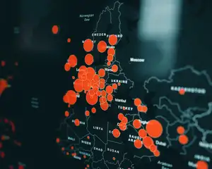
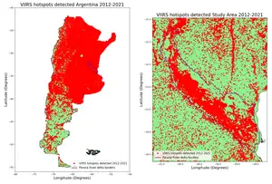
GIS alongside open-source programming languages allows users to map out data, analyze it, and share the results. GIS programs can be used for a variety of tasks, such as mapping crime rates across cities or determining whether certain areas have adequate access to fresh water. These applications are often very specific in nature and require highly skilled programmers to create them—therefore making GIS software proprietary software is not financially feasible for most companies who would benefit from its use.
Open source GIS programs provide a solution by allowing anyone with access to the internet or a computer running Windows OS or Mac OS X operating systems with an internet connection to use these powerful tools at no cost.
Proprietary GIS Software is Expensive
Open source GIS software is free and doesn’t require you to pay any licensing fees. Proprietary GIS software, on the other hand, requires payment of licensing fees. One of the main advantages of open source GIS software is that it can be freely used, modified, and redistributed with no limitation or restriction. This allows users to customize the program as they see fit. Open source GIS also aid in collaboration because multiple people can work on the same projects at once without having to share files back and forth.
Open Source GIS Can Do the Same Work as Proprietary GIS but Without Additional Costs.
Open source GIS software often has similar capabilities as proprietary GIS programs but you don't have to pay any money upfront or per use. For example, an open source version of ArcGIS called QGIS performs nearly identically to ArcMap and does not cost anything and can be installed on as many computers as you want. Anyone with access to the internet and a modern computer can download and install QGIS.
Conclusion
Open source GIS software is an incredibly powerful tool, and it can do the same work as proprietary GIS. However, open source won't cost you anything to use or manage. You can download and install open source programs for free without paying any license fees to a vendor. Open source GIS software is an alternative to proprietary GIS software. This means that it can do the same work as proprietary GIS but without additional costs. Open source GIS also allows users to modify and adapt it to suit their needs, which makes it useful for many different applications.


