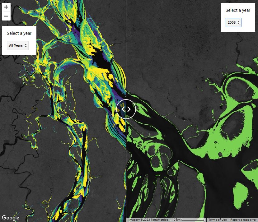
Mapping the global distribution and trajectory tidal flat ecosystems. This dataset was created from over seven hundred thousand satellite images to be the first worldwide distribution and change dataset for tidal flats with a thirty year history. Murray N. J., Phinn S. R., DeWitt M., Ferrari R., Johnston R., Lyons M. B., Clinton N., Thau D. & Fuller R. A. (2019) The global distribution and trajectory of tidal flats. Nature. 565:222-225. http://dx.doi.org/10.1038/s41586-018-0805-8
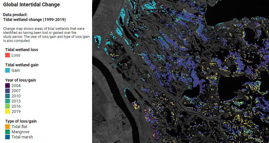
Designed to monitor change of Earth's intertidal ecosystems. This project contains three datasets:Tidal wetland distribution, Tidal wetland change, Training data.Murray, N. J., T. A. Worthington, P. Bunting, S. Duce, V. Hagger, C. E. Lovelock, R. Lucas, M. I. Saunders, M. Sheaves, M. Spalding, N. J. Waltham & M. B. Lyons (2022). "High-resolution mapping of losses and gains of Earth's tidal wetlands." Science. 376, 744-749. doi:10.1126/science.abm9583
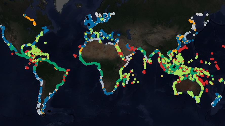
Open-access reference library of coastal ecosystems suitable for training and verifying the latest generation of remote sensing classification models. The classes available in this dataset are: Tidal flat, Mangrove, Coral reef, Tidal marsh, Seagrass, Rocky intertidal, Kelp forest, Other (Land), Other (Water).Github Repo.Murray, N. J., Bunting, P., Canto, R., Hilarides, L., Kennedy, E. V., Lucas, R., Lyons, M. B., Navarro, A., Roelfsema, C. M., Rosenqvist, A., Spalding, M., Toor, M. & Worthington, T. A. (2022) coastTrain: a global reference library for coastal ecosystems. Remote Sensing. https://doi.org/10.3390/rs14225766